Mike Bush is a guest blogger and a PhD student in the Trexler aquatic ecology lab at FIU (
http://faculty.fiu.edu/~trexlerj/).
-------------------------------------------------------------------------------------------------------------
 Everglades restoration can come in many forms, from ensuring that water heading south through the Everglades Agricultural Area is stripped of excess nutrients before it hits the more natural areas of the Everglades to shuffling around huge amounts of water under Alligator Alley into Fakahatchee Strand.
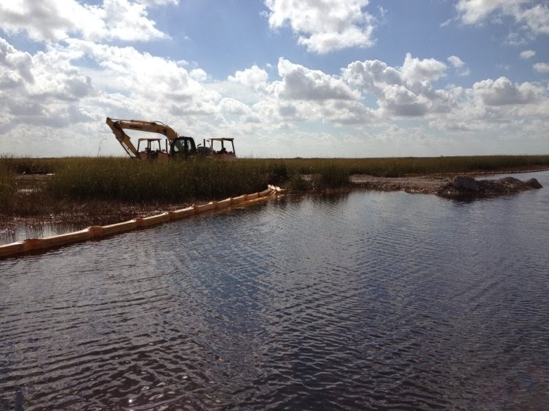
 Perhaps no project is as ambitious as the Water Conservation Area 3A Decompartmentalization and Sheetflow Enhancement Project (we just refer to it as “DPM” or “Decomp” for short, thank goodness). DPM is a multifaceted project, with major involvement by the South Florida Water Management District and the US Army Corps of Engineers, that focuses on removing levees and plugging canals that are found throughout the Everglades, hence the “decompartmentalize” part. The overarching goal here is to restore sheetflow, that slow moving conveyance of water through the Everglades that inspired Marjory Stoneman Douglas’ phrase “River of Grass”. A component of DPM is the DPM Physical Model, the first step in testing how restoration of sheetflow will affect sediment and nutrient transport. This in turn could affect the plants and animals of the system, including how the ridge-and-slow structure of the Everglades is maintained or altered.

Construction for the project about a year ago, and the lab I’m in has been collecting fish, amphibian, and aquatic invertebrate data since Fall 2010. Water is projected to flow east from a section of the Everglades known as Water Conservation Area 3A, through a series of culverts in the L67-A levee, across a roughly 1 mile section of marsh known as the “Gap” or “Pocket”, and then across the L67-C canal and levee into Water Conservation Area 3B. The C canal, where many of my field sites are, has either been filled in entirely or partially filled across the experimental zone. This will examine whether future restoration projects can get away with just partial canal fills, a much cheaper option than filling a deep canal with earth all the way to marsh level. The project is finally complete and today the culverts in the A levee were opened. Today, known to many in many agencies and institutions as “Flow Day”, is the first day in what hopes to be a great day for Everglades restoration.
I am amazed at how much manpower and collaboration goes in to trying to restore natural components of the Everglades landscape. And it’s certainly odd to spend so much time out here with no other humans (besides some very dedicated and excellent field technicians), and suddenly there’s a fleet of dump trucks and earth movers out in the middle of the Everglades! Well worth the effort though for this exciting (and necessary) project for restoration.
I’ll post aerial photos within the next couple of weeks! Stay tuned! Photo credits go to Sabrina Schneider, one of those very excellent techs I spoke of.

 Everglades restoration can come in many forms, from ensuring that water heading south through the Everglades Agricultural Area is stripped of excess nutrients before it hits the more natural areas of the Everglades to shuffling around huge amounts of water under Alligator Alley into Fakahatchee Strand.
No comments:
Post a Comment